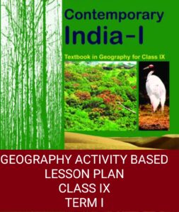
GEOGRAPHY LESSON PLAN- IX
Geography lesson plan for class IX may be helpful to you. Planning your lessons are essential to complete within the given time frame. Moreover, it does not allow you to get deviated from the topic. “By failing to prepare, you are preparing to fail.”
Geography lesson plan also includes aims and objectives of the chapter.
The purpose of writing Geography lesson plans-IX is to make sure that every student understands the lesson.
The teacher may have to adopt different explanation methods to make the topic clear.
Activities recommended by the CBSE are also mentioned in Geography lesson plan-IX.
An organized teacher has to deliver the lesson, conduct activities, and access each child within limited time.
Teachers also have to prepare their children for competitive exams like NTSE NSO, HERITAGE QUIZ etc.
If you are a new teacher, this article will help you.
If you want Social Science Lesson Plan For Class VII with Classroom Activities – Term I click on the link.
With few years of experience, you will be able to guide others on how to prepare good lesson plan for class ix?
Geography lesson plan – IX
Chapters included:
- INDIA – SIZE AND LOCATION
- PHYSICAL FEATURES OF INDIA
- DRAINAGE
1. CHAPTER 1:
India: size and location
2. OBJECTIVE:
- Firstly, To know the location of India in terms of LATITUDES & LONGITUDES
- Understand the position, and neighbors of India.
- To understand the advantage of it’s location in the Indian ocean.
- To learn to calculate time difference with the help of Longitudes.
3. TEACHING AIDS / TOOLS AND TECHNIQUES
(I) TOOLS:
NCERT Text- book, Map of India, PPT.
(ii) TECHNIQUES/METHOD:
Explanation with the help of map and diagrams.
The teacher first introduces the topic to the class.
Checks their knowledge and understanding of the Lines on the globe namely Latitudes and Longitudes.
Explains the India’s NORTH-SOUTH & EAST-WEST extent.
Discusses about the Indian states, and about the three water bodies which surrounds India.
Further, the teacher discusses about the directions and sub-directions, Tropic of Cancer and India’s neighboring countries.
In due course of time, the teacher explains “TIME CALCULATIONS” India-size and location and the importance of India’s location in the Indian ocean.
While explaining the chapter, the teacher introduces some Geographical terms like Subcontinent, Peninsula, Gulf etc.
ACTIVITY: (TO BE INCLUDED IN GEOGRAPHY LESSON PLAN)
NAME:
Map work
TOPIC COVERED:
Location and identification of Indian states.
OBJECTIVE:
To know about the location of different states on the outline map of India.
SKILLS DEVELOPED:
i) children learn to identify the states.
ii) Children will know the location of Indian states.
TIME REQUIRED:
1 Period
METHOD:
The teacher divides the class into five groups and gives 5 questions to each like
i) mark the desert states of India.
ii) two states which have a common capital.
iii) Group of states called the seven sisters.
iv) Name the states through which Tropic of Cancer passes.
v) Name the Indian states which borders Nepal.
ASSESSMENT CRITERIA:
The teacher will collect all five maps from each group and for each correct place one mark will be awarded.
ACTIVITY II – Map work (indoor)
TOPIC COVERED:
The location of India at the head of the Indian ocean.
OBJECTIVE:
To understand the importance of India’s location at the head of the Indian ocean.
TIME REQUIRED:
1 Period
METHOD/PROCEDURE:
Picture related. (Map)
The teacher divides the class into 5 groups.
Distributes a map (picture) to each group.
INSTRUCTIONS:
Find out who came to India via which sea अंडमान और निकोबार द्वीप समूह route.
Mark the important trade centers of India (Each group can be given 1 topic)
ASSESSMENT CRITERIA:
The activity will be checked on the the following points:
i) Presentation
ii) Information
iii) Maps of the routes taken.
NOTE: All the five maps will be displayed on class board.
SKILLS DEVELOPED:
understanding of the topic and importance of location.
4. CLASS WORK:
Different type of questions and map related work will be done in the class.
5. HOME-WORK PLANNED:
I) Revise the topics taught in the class.
ii) Time calculation Assam Tea Gardens Have Their Own Time related problems.
VALUE: Students will develop a sense of Patriotism for their Motherland.
6. FORMATIVE ASSESSMENT:
All types of questions will be asked to the students to check their knowledge and understanding.
7. REMEDIAL MEASURES:
Pair and share
8. LEARNING OUTCOMES:
i) Develops conceptual skills.
ii) Identification of various sea routes and the importance of India’s location.
Geography lesson plan – IX
CHAPTER 2
PHYSICAL FEATURES OF INDIA
1 OBJECTIVE: (GEOGRAPHY LESSON PLANS)
- Students will know about the different physical features of India.
- They will also understand the formation of such features.
2 TOOLS AND TECHNIQUES/METHODOLOGY
TOOLS: NCERT Text-book, chalk and black-board, https://www.slideshare.net/indrani97321/sst-ppt-on-physical-features-of-india
Physical map of India.
TECHNIQUE:
Explanation with the help of diagrams on the board.
The teacher first explains the term physical features and Introduces the term plate tectonics..
With the help of diagram, क्यों आते हैं जापान में भूकंप-ज्वालामुखी-सुनामी ? the teacher explains the two huge landmasses and the formation of Himalayas.
Similarly, बरमुडा त्रिकोण – formation and importance of other physical features will be discussed.
ACTIVITY:
TOPIC COVERED:
Physical features of India.
OBJECTIVE:
To know the important features of each physical feature of India.
SKILLS DEVELOPED:
understanding of the topic.
TIME REQUIRED:
1 Period
METHOD:
The teacher prepares five cards.
Writes five features of each physical division and put these in different envelopes.
Ask students to write any five features of suppose The Indian desert.
Call a student, ask him to open the envelope and read about the features written on it.
Ask the students to match all the points with the card.
Similarly, call another student to open the next envelope for next feature say “The Northern Mountains.”
In this way all the PHYSICAL DIVISIONS OF INDIA – CLASS IX can be revised easily
ASSESSMENT CRITERIA:
This activity will not be assessed.
NOTE: All the five cards will be displayed on the class board.
4. CLASS WORK:
Different type of questions and map related work will be done in the class.
5. HOME-WORK PLANNED:
I) Revise the topics taught in the class.
ii) Make a Physical map of India using Dough https://www.youtube.com/watch?v=IWslVIr9ZsI&t=1s or clay.
VALUE: Children will learn to appreciate the diverse features of India.
ACTIVITY II:
TOPIC COVERED:
Eastern and Western Ghats.
OBJECTIVE:
To know the important features of Deccan plateau.
SKILLS DEVELOPED:
understanding of the topic.
TIME REQUIRED:
1 Period
METHOD:
The teacher divides the class according to the height of students.
The taller ones are asked to stand on the western side.
The smaller ones will stand on the eastern side by forming small groups.
Ask the tallest student to hold a paper written as Anai Mudi ( Highest peak)
They can be named as Annamalai, Cardomom, Nilgiri etc.
Ask any one student to read out the difference between Western and Eastern Ghats.
ASSESSMENT CRITERIA:
This activity will not be assessed.
NOTE: While the students are involved in the SOCIAL SCIENCE ACTIVITIES , take the photos.
6. FORMATIVE ASSESSMENT:
All types of questions will be asked to the students to check their knowledge and understanding.
7. REMEDIAL MEASURES:
PAIR AND SHARE
8. LEARNING OUTCOME:
After reading the chapter, the students will be able to –
- Firstly, relate the importance of all Relief features.CLASS IX GEOGRAPHY CHAPTER 2
- Secondly, to know the importance of Himalayas.
- Thirdly, Identify the role of natural forces causing changes in the earth’s landforms.
- to Assess the role of northern plains as food bowl of India
- Learn the difference between Western and Eastern Ghats
- Lastly, Locate, label and identify various mountain passes, peaks and other important Natural features.
Geography lesson plan – IX
Chapter 3- Drainage
INTRODUCTION:
Drainage means flow of water.
The flow of excess water from the ground is called drainage.
In this chapter children will learn about the flow of Himalayan and peninsular rivers.
Drainage can be natural or artificial.
Moreover, The purpose of reading this chapter is to learn how can the excess water can be easily diverted to the regions where there is shortage of water.
1.TOPIC: (TO BE INCLUDED IN GEOGRAPHY LESSON PLAN)
DRAINAGE
2. OBECTIVE
Students will be able to
i) differentiate between drainage and drainage basin.
ii) identify various drainage patterns.
iii) compare the east and west flowing rivers.
Locate and label important rivers and lakes if India in the map.
3. TOOLS AND TECHNIQUES/METHODOLOGY:
(I) TOOLS:
NCERT Text- book, Map of India -Physical and Political, PPT.
(ii) TECHNIQUES/METHOD:
Explanation with the help of map and diagrams.
The teacher begins the class with brain storming session.
Meanwhile, Introduces the term drainage.
Discusses about drainage basin and water divide.
With the help of white-board and diagrams the teacher make the students understand
the concept of water divide and various drainage patterns.
By using story telling method, the teacher explains the journey of a river from source to mouth.
ACTIVITY I
NAME: MAP ACTIVITY
TOPIC COVERED:
Rivers and lakes.
OBJECTIVE:
To know the location of important lakes and rivers.
SKILLS DEVELOPED:
Knowledge, Understanding, Analytical skills.
TIME REQUIRED:
1 Period
METHOD:
The teacher divides the class into two groups.
One group is given the topic Himalayan rivers.
The other group gets the topic Peninsular rivers.
The teacher asks both the groups to read and note down important features related to their topic.
After, 20 minutes,
the teacher calls a child from each group and asks them to present their findings before the class.
Children easily understands the difference between Himalayan and Peninsular rivers.
ASSESSMENT CRITERIA:
This activity will not be assessed.
NOTE: Collect the findings of students and pin up on the class display board.
ACTIVITY II
NAME:
Map work
TOPIC COVERED:
Rivers and Lakes In India
OBJECTIVE:
To know about the location of important rivers and lakes.
SKILLS DEVELOPED:
i) children learn to identify the rivers
ii) Children will know the location of Indian rivers and lakes.
TIME REQUIRED:
1 Period
METHOD:
The teacher asks the students to take out an outline map of India.
(one map will be shared by two students)
Now, the teacher gives 5 minutes time to see the important rivers and lakes from the textbook
After, 5 minutes, students will be asked to close their textbooks.
The teacher asks them to mark the following rivers DELTA AND ESTUARY and lakes in their maps.
i) Godavari ii) Satluj iii) Tapi iv) Chilika and v) Sambhar.
KNOW ABOUT DELTA AND ESTUARY IN JUST TWO MINUTES BY WATCHING THE FOLLOWING VDO.
ASSESSMENT CRITERIA:
When the work is done, the teacher asks the students to exchange their maps.
Also asks them to award marks.
For each correct place one mark will be awarded.
The teacher collects all the maps and note down the marks.
The teacher will award marks on three points: Neatness, accuracy and Labelling.
4. CLASS WORK:
Children will do different type of questions and map related work in the class.
5. HOME-WORK PLANNED:
I) Revise the topics taught in the class.
ii)Also write an essay on ” How the rivers get polluted”
6. INTERDISCIPLINARY ACTIVITIES:
ENGLISH: Write a letter to the editor about the dirty and contaminated river water in your area.
HINDI: Write slogans in Hindi to save river and to create awareness.
7. FORMATIVE ASSESSMENT:
Children will be assessed on all type of questions namely Objective,
short and long answer, Map etc.
8. REMEDIAL MEASURES:
The teacher will conduct extra class for the slow learners बच्चे पढाई में क्यों कमज़ोर होते हैं ?.
He She may simplify the difficult content.
Will distribute handouts and explain the terms/concepts again if needed.
A separate question paper may be prepared for slow learners to assess their performance.
9. LEARNING OUTCOMES:
i) Develops conceptual skills.
ii) Valuing the Natural resources.
Conclusion:
“Geography lesson plan” has been written to help the teachers.
New teachers may get some better ideas to plan their lessons.
There is no fixed format or columns for making lesson plans.
It varies from school to school.
If you have taken any activity in the class, do not hesitate to share.
Let’s learn from each other.
Was this article helpful to you in any way?
Please share with your friends and give your honest feedback in the comment box. For complete activity based lesson plan for class vii term I click on the link Social Science Lesson Plan For Class VII with Classroom Activities – Term I
“LOVE ONLY GROWS BY SHARING. YOU CAN ONLY HAVE MORE FOR YOURSELF BY GIVING IT AWAY TO OTHERS”
Your sharing can bring a smile on somebody’s face.
Your suggestions will mean a lot.


Pl send 8th lesson plan for social January and February month
Yes, sure. We are working on it. Very soon it will be there. Keep visiting.
Please send politics and economics lesson plan for class 9 and 10
I must thank you sir for such an innovative lesson plan!
The activities are very practical to be done in class. I am sure to implement these activities in my class in the upcoming session.
Looking forward to more such plans from you.
Thanks once again
Please send politics and economics lesson plan for class 9 and 10
Thank you Divya for your valuable feedback. We are working on it. Very soon you will get it on my website. Keep visiting.
Thanks and Regards