


Class 9 Geography Chapter 1 India – Size and Location Explained
Class 9 Geography Chapter 1 India – Size and Location Explained to make the students understand this chapter. Although this chapter of class 9 seems to be a small chapter, actually it is not. To understand Class 9 Geography Chapter 1 India – Size and Location, you must have a better understanding of the Globe, Directions, Latitudes, and Longitudes. If these things are clear to you, this chapter of Class 9 Geography Chapter 1 India – Size and Location will be very easy to understand. So, without wasting any time, let’s begin the chapter.
India – Size and Location: Competency Based Questions For Class IX Geography Enthusiasts
What Are 8°4′ N and 37°6′N? Explained From India Size and Location
You must have seen a globe.
There are many (imaginary) lines on it.
These imaginary lines are called latitudes and longitudes.
Latitudes are complete circles and are 180 in number.
Between two degrees of latitude, there are 60 sub-divisions.
These sub-divisions are called minutes.
As in a clock, between 1 and 2, there are 4 sub-divisions which are called the minutes.
This is important to understand the latitudinal extent of India which is 8° 4′ N to 37°6′N.
Latitudes are the angular distance from the sun.
For example, if you draw 30 degrees North, it means that the place forms a 30-degree angle from the center of the earth.
What Are 68°7′ E and 97°25′ E? Explained From India – Size and Location
How to calculate time using longitudes explained Step by step
Longitudes are semi-circles and are 360 in number.
There are 360 longitudes because our earth is spherical (round) in shape and a circle is 360 degrees.
These longitudes start from the North Pole and end at the South pole.
The maximum distance between two longitudes is at the equator (111km) and the minimum is at the poles.
In between two Longitudes also there are 60 sub-divisions called minutes.
That is why India’s longitudinal extent is 68°7′ E and 97°25′ E.
This is read as 68 degrees and 7 minutes east and 97 degrees 25 minutes east.
0° longitude is called Prime Meridian.
It Passes through Greenwich in England.
Longitudes are used in time calculation.
Do you know 180° longitude is called the International Date Line and this is not straight?
Now, you must have understood why the knowledge of Latitudes and longitudes is so important.
India’s Extent and It’s Location
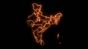
India map with all states or provinces glowing neon outline in and out animation.
India’s extension from the easternmost part to the westernmost part is 2933 km.
Whereas India’s North-South extent is 3214 km.
Our country India is one of the seventh-largest countries in the world.
Moreover, it occupies 2.4 % of the area of world.
India lies in the Northern as well as Eastern Hemisphere.
Northern Hemisphere because it entirely lies above the equator.
That is the reason why we write its latitudinal extent as 8° 4′ N to 37°6′N.
Similarly, India is also located in the Eastern Hemisphere because it lies to the east of 0-degree longitude (Prime Meridian.)
That is the reason why we write its longitudinal extent as 68°7′ E and 97°25′ E.
Understanding How the Latitudinal and Longitudinal Extension of India is 30°?
As we know that India’s Latitudinal extent is from 8° to 37°North (approx)
It means if you count the number of latitudes like 8,9,10, 11, 12………. up to 37, The total count is 30.
That is why there are a total of 30 latitudes passes through India.
Similarly, India’s Longitudinal extent is approximately 68° to 97° East.
Again, if you count the number of longitudes like 68,69, 70, 71…………..up to 97, The total count is 30.
That is why there are a total of 30 longitude passes through India.
Now, the question arises,
if the no. of latitudes and the No. of longitudes are the same as 30, then why the east-west and the North-South distance varies?
Let’s understand it pointwise.
The distance between lines of latitude remains the same at all places i.e. 111km.
But, India is located away from the equator.
The lines of longitude come nearer to each other as we move toward the pole.
Therefore, the distance between 30 latitudes will not be the same as 30 longitudes.
That is why the East-West distance becomes less than the North-South distance.
Why Is India Called A Peninsula?
A peninsula is a piece of Land that is surrounded by water from three sides.
As India is surrounded by water from three sides namely,
the Bay of Bengal in the east, the Arabian sea in the West, and the Indian Ocean in the South, India is called a peninsula.
Why Is India a Sub-continent?
Actually, India should have been a continent.
It actually fulfills the definition of a continent.
Let’s see what is the definition of a Continent.
Firstly, It is the seventh largest country in the world.
Secondly, it is Separated by the mighty Himalayas in the North which is a natural barrier, and
Finally, also separated by sea and Oceans from East, West, and South.
India has not been given the status of a continent because of its Euro-Centric mentality.
It has nothing to do with the definition of a continent.
Europe is a continent that does not fulfill the definition of a continent but they consider itself rich,
developed, and superior to others and hence separated itself from Asia.
India is called a subcontinent because:
- it covers a wide area of land.
- has a distinct geographical, political, and cultural identity.
- The countries that form part of the Indian subcontinent are India, Bangladesh, Pakistan, Nepal, Sri Lanka, Maldives, and Bhutan.
India and the world:
Our country India has got a beautiful location.
It is well-connected with European and African countries from the west through the Arabian sea.
From the East, it is connected to South-Asian countries like Japan and Australia.
India lies at the head of the Indian Ocean through which the major sea route of the world passes.
Moreover, the opening of the Suez canal in 1969 reduced the distance between Europe and India by 7000 km.
India was well connected by land routes during the ancient time also known as the silk route.
Conclusion: India – Size and Location Explained:
We hope that the core concepts from the chapter India – Size and Location are now clear. The latitudinal and longitudinal extension given in the chapter India – Size and Location are not explained in detail. Although, India – Size and Location chapter is small but very interesting.
India – Size and Location: Competency Based Questions For Class IX Geography Enthusiasts


I am truly thankful to the owner of this web site who has shared this fantastic piece of writing at at this place.