


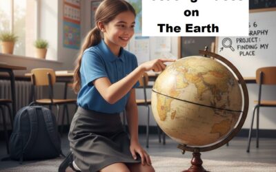
Class 6 NCERT Oceans and Continents Lesson Plan
Class 6 NCERT Oceans and Continents Lesson Plan is in accordance with CBSE requirements. It educates the fundamental characteristics of the Earth in an understandable and straightforward manner. Using maps, globes, and illustrations, the Class 6 Oceans and Continents Lesson Plan helps students understand better. It adheres to the CBSE’s emphasis on competency-based education. Through exercises, discussions, and observation, students gain knowledge. They enhance the ability to read maps and think critically. Additionally, the lesson helps kids comprehend the significance of water and land on Earth.
The Class 6 Oceans and Continents lesson plan ties geography to everyday life and environmental consciousness. It encourages students to participate actively in class. It also promotes curiosity and enquiries. All things considered, it facilitates the full development of values, abilities, and knowledge in a fun and simple manner. For Class 6 Geography lesson plan of Chapter-1 click on the given link NEP 2020 Aligned Lesson Plans for Class 6 New NCERT Social Science – Ready-to-Use Format
Class 6 NCERT Oceans and Continents Lesson Plan
Chapter 2 – Oceans and Continents
General Information
- Class: VI
- Subject: Social Science (Geography)
- Chapter: Oceans and Continents
- Duration: 6–8 Periods (40 minutes each)
- Approach: Experiential & Competency-Based Learning
- Assessment Type: Formative + Map Skills
Objectives
- Firstly, to assist children in recognizing the globe and world map’s seven continents and five oceans.
- Secondly, to help students comprehend how land and water are distributed throughout the planet.
- Thirdly, to cultivate fundamental globe-handling and map-reading abilities.
- Fourthly, to describe the significance of continents and oceans for trade, climate, and human life.
- thereafter, to describe the significance of continents and oceans for trade, climate, and human life.
- Further, to increase knowledge of the Earth’s physical characteristics and their importance on a global scale and
- Finally, to foster curiosity, critical thinking, and observation of their surroundings.
2. Teaching Aids
- Globe
- Political & Physical World Map
- Atlas
- PPT / Smart Board
- Blank outline maps
- Worksheet (Coordinate practice)
- Flash cards (Important lines)
3. Teaching Methodology:
Globe and Map Introduction:
To help students visually identify the seven continents and five oceans, start the course by displaying a globe and a world map.
Interactive Questioning:
To foster curiosity and prior knowledge, use straightforward, thought-provoking questions such as
“Which is the largest continent?” or “Which ocean is the deepest ?”
Engage children in activity-based learning by having them label blank outline maps with the names of continents and oceans.
Audio-Visual Aids:
To illustrate how land and water are distributed on Earth, use brief animated films or PowerPoint presentations.
Group Discussion:
Assign students to groups and give them each a continent or ocean to highlight important qualities.
Assessment and Reinforcement:
To reinforce learning objectives, finish with brief tests, worksheets, and homework assignments.
4. Teaching Learning Process:
Engaging Introduction:
To activate prior knowledge, the instructor shows the class a globe or world map and asks them to note how land and water are distributed on the planet.
Concept Explanation:
Using an appropriate map demonstration, the teacher highlights the seven continents and five oceans to illustrate the meaning of these geographical features.
Students engage in interactive learning by asking questions, having discussions, and identifying the continents and oceans on the globe and atlas.
Activity-Based Practice:
Students color various continents and oceans, finish map-labeling assignments, and make crude drawings of the world map.
Collaborative Learning:
In groups, students gather and present important information on designated continents or oceans, such as the largest, smallest, deepest, etc.
Class 6 NCERT Oceans and Continents Lesson Plan
Chapter 2 – Oceans and Continents
5. Week-Wise Development of Lesson:
Week 1: Overview of the Surface of the Earth
Explain the idea of the distribution of land and water on Earth.
Describe the meanings of the terms ocean and continent.
To identify the five oceans and seven continents, display a globe and a world map.
Ask questions aloud and carry out basic map observation exercises.
Learning Goals:
The distribution of land and water on Earth will be understood by the students.
Oceans and continents will be defined by the students.
Students will use a globe to identify the continents and oceans.
The process of teaching and learning
The teacher illustrates that roughly 71% of Earth is made up of water and 29% is made up of land using a globe and a world map.
Definitions of continent and ocean are explained with illustrations.
asking interactive questions to gauge past knowledge.
Activity:
Students look at the globe and distinguish between land and sea.
This coloring page depicts water (blue) and land (brown/green).
Evaluation:
Brief worksheet and spoken questions.
Assignment:
List the names of five oceans and seven continents.
Week Two: Studying Continents
Each continent—Asia, Africa, North America, South America, Antarctica, Europe, and Australia—is explained in detail.
Talk about the major continents’ locations, sizes, and salient characteristics.
Practice labeling maps and worksheet exercises.
Group exercise: One continent is presented by each group.
Learning Goals:
The seven continents will be named and located by the students.
Students will outline each continent’s salient characteristics.
The process of teaching and learning
Detailed explanation of continents using world map.
Highlight key facts (largest continent Asia, smallest Australia, etc.).
Atlas work and discussion.
Activity:
Map labeling of Asia, Africa, North America, South America, Antarctica, Europe, and Australia.
Group presentation on one assigned continent.
Assessment:
Map test (locating continents).
Short written answers on important features
Week 3: Oceans Study
Describe the Pacific, Atlantic, Indian, Southern, and Arctic oceans.
Talk about the seas’ size, depth, and significance.
Use PowerPoint or movies to improve comprehension.
For reinforcement, administer a test and assign atlas work.
Learning Goals:
The five oceans will be recognized and located by the students.
Students will discuss the significance of oceans.
The process of teaching and learning
An explanation of the five oceans
The Pacific Ocean
The Atlantic Ocean
The Indian Ocean
The Southern Ocean
The Arctic Sea
Size, depth, and usage (marine life, commerce routes, climate impact) are discussed.
utilizing PowerPoint or brief instructional films.
Activity:
On a blank outline map, label the oceans.
Take a quiz about the deepest, smallest, and largest oceans.
Evaluation:
worksheet and a test conducted orally.
Write five ways that seas can be used as homework.
Week 4: Evaluation and Revision
Using interactive discussion, recap every continent and ocean.
Perform a map test and a brief written evaluation.
Give weak learners remedial instruction.
Assign project work (global map drawing and labeling).
Learning Goals:
Students will solidify their understanding of oceans and continents.
On a map, students will find them precisely.
The process of teaching and learning
Recapitulation by means of dialogue and inquiry.
Doubt clarification and remedial instruction.
Activity:
Create a globe map project and label it.
Hold a quiz contest in class.
Evaluation:
written exam consisting of short answers and map tasks.
For sluggish learners, individualized feedback and remedial assistance are provided.
Class 6 NCERT Oceans and Continents Lesson Plan
Chapter 2 – Oceans and Continents
6. Learning Outcomes:
- Students will be able to correctly identify and locate the five oceans and seven continents on a globe and world map.
- Based on their size, characteristics, and significance, students will be able to distinguish between seas and continents.
- Students will be able to explain why the Earth is known as the “Blue Planet” and comprehend how land and water are distributed across the planet’s surface.
- Further, the students will be able to succinctly describe the key physical characteristics of each continent and ocean.
7. Closure:
The instructor will quickly go over the names and locations of the five oceans and seven continents at the conclusion of the class.
A few oral questions will be posed to the students in order to assess their comprehension.
To further reinforce information, a brief map exercise will be provided.
The instructor will address any lingering questions and relate the subject to the following lesson.
8. Class Work:
On a blank globe map, mark the five oceans and seven continents.
Write brief remarks about any two continents and any two oceans, no more than three or four lines apiece.
Make a basic diagram that illustrates how water and land are distributed on Earth.
Fill in the blanks, match the following, and map- based questions on a worksheet.
9. Home – Work
Home-Work: Continents and Oceans
Acquire and review the names and spellings of every ocean and continent.
In the notebook, make a tidy, labeled global map.
Write five sentences outlining the reasons the Earth is referred to as the “Blue Planet.”
Write down one fascinating information about each continent and ocean in your notepad.
Complete the chapter-related textbook exercise questions.
Class 6 NCERT Oceans and Continents Lesson Plan
Chapter 2 – Oceans and Continents
10. Activities:
Map Labelling Activity:
Students label the five oceans and seven continents on a blank world map as part of this map labeling exercise.
Globe Identification Game:
After the teacher names the continents and oceans, the students must locate them on the globe.
Puzzle or Matching Activity:
Students match continents according to their distinctive characteristics (biggest, coldest, etc.) in a puzzle or matching exercise.
Group Presentation Activity:
Students work in small groups to create a brief presentation or chart about a single continent or ocean, which they then deliver to the class.
11. Assignments:
A. Very Short Answer Questions (1–2 sentences)
Name all the Continents.
What are Oceans? Name all the oceans.
Which continent is the largest?
Name the smallest continent?
Why is the Earth called the “Blue Planet”?
B. Short Answer Questions (3–4 sentences)
Differentiate between an ocean and a continent.
Describe the location of Asia with respect to other continents.
Write 5 sentences on the Pacific Ocean.
How do oceans influence climate?
C. Map Work
On a blank outline map of the world:
- Mark and label all seven continents.
- Mark and name all five oceans.
D. Activity-Based Assignment
Prepare a colourful chart showing the distribution of land and water on the Earth.
Collect three interesting facts about any one continent and present them in class.
E. Higher Order Thinking Question (HOTS)
What would happen if there were more land than water on the Earth? Explain in 4–5 sentences.
12. Assessment Strategy:
1. Formative Assessment (Assessment for Learning)
To be conducted continuously during the teaching–learning process:
Oral questions will be asked during the explanation and discussion.
Monitoring students’ participation in map and globe activities.
Completion of the Worksheet (fill in the blanks, matching & writing short answers).
Assessment of the Group activity and presentation in the class.
Completion of the notebook and homework.
2. Summative Assessment (Assessment of Learning)
Conducted at the end of the lesson/unit:
Written test including objective and descriptive questions.
Map-based test to assess locating skills.
Project or assignment evaluation.
Unit test or periodic test covering the complete chapter.
13. Differentiated Instruction
For Slow Learners
to clearly explain concepts by using globes, maps, and illustrations in simple language.
By providing the students map labeling practice under supervision.
Asking simple, concise, and well-structured questions.
By providing peer help in small groups.
Encouraging them to do revision worksheets and frequent oral reinforcement.
For Advanced Learners
By assigning additional map work and research-based assignments.
Encourage them to compare all continents based on climate, size, location, and population.
to provide project work such as preparing a detailed PPT on any one continent or ocean.
Improving their analytical abilities by asking higher-order thinking questions.
to promote participation in quizzes and geography-related competitions.
14. Learning Outcomes:
16. Integration with Other Subjects
Linking With History
Discuss how continents affected trade and exploration and find out why the early civilizations developed near oceans and rivers.
Linking With Science
Make a connection with the water cycle, climate, and the importance of oceans in maintaining the Earth’s temperature.
Linking With Mathematics
Use scale, distance measurement, and calculation of area to understand maps.
Linking With English
Write short paragraphs or essays on any one continent or ocean to improve language skills.
Art Integration
Students will be asked to draw and colour a world map showing continents and oceans.
17. Evaluation Rubric
| Criteria | Excellent (4) | Good (3) | Satisfactory (2) | Needs Improvement (1) |
|---|
| Conceptual Understanding | Clearly explains all concepts with accuracy and examples | Explains most concepts correctly | Basic understanding but some errors | Shows limited understanding |
| Map Skills | Accurately labels all continents and oceans | Minor errors in labelling | Several errors in labelling | Unable to label correctly |
| Participation | Actively participates in all activities and discussions | Participates regularly | Participates occasionally | Rarely participates |
| Presentation / Project Work | Well-organized, neat, creative, and informative | Organized and neat | Basic presentation with limited details | Incomplete or poorly presented |
| Homework & Notebook Work | Complete, neat, and submitted on time | Mostly complete and neat | Incomplete or untidy work | Not submitted or very incomplete |
18. NEP 2020 Alignment:
Experiential learning
According to the National Education Policy 2020, experiential learning promotes learning through maps, globes, group projects, and practical exercises. Instead of rote learning,
Competency-based education
competency-based education emphasizes the development of map skills, spatial awareness, critical thinking, and knowledge application.
Multidisciplinary Approach
Geography is integrated with history, science, math, art, and language study through a multidisciplinary approach.
Skill Development
Through projects and activities, skill development fosters observation, analysis, teamwork, and presentation abilities.
inclusive Education
In order to guarantee that every student learns, inclusive education offers remedial assistance and individualized training.
Assessment Reform:
As recommended by NEP 2020, this approach places a strong emphasis on formative assessment, competency-based questions, and ongoing review.
Class 6 NCERT Oceans and Continents Lesson Plan
Chapter 2 – Oceans and Continents
Conclusion:
The Class 6 NCERT Oceans and Continents Lesson Plan is in accordance with the National Education Policy 2020. It reflects a shift from rote learning to competency-based and experiential education. Through ecercises, projects, and debates, the Class 6 NCERT Oceans and Continents Lesson Plan focuses on conceptual clarity. Moreover, it integrates multidisciplinary learning by connecting Geography with History, Science, Mathematics, Art, and Language, ensuring holistic development. The lesson plan also emphasizes differentiated instruction, formative and summative assessment, and remedial measures to address diverse learning needs. Through hands-on map work, globe activities, and collaborative tasks, students develop spatial awareness, critical thinking, and communication skills. Overall, the Class 6 NCERT Oceans and Continents Lesson Plan aligns with NEP 2020’s vision of creating informed, skilled, and responsible learners who understand the world around them in a meaningful and engaging way.

0 Comments